Restoration planned for Rupa, the hidden glacial lake beneath R'zhana
Pelister National Park will restore the Rupa basin and renovate the French trail to improve ranger work and open the seasonal lake to visitors.
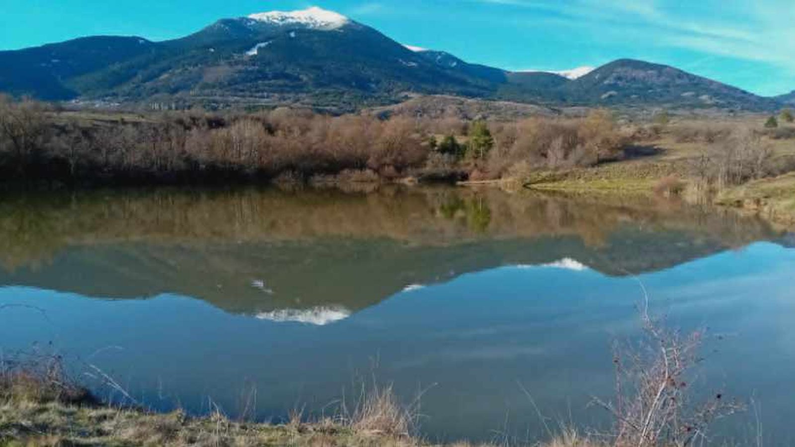
Pelister National Park has announced plans to restore Rupa, a small seasonal glacial lake tucked below the summit of R'zhana (2,334 m a.s.l.), and to rehabilitate the old French trail that runs from Golemo Ezero on Pelister to Brajčino in Prespa, opening the spot to visitors.
The Rupa basin lies immediately beneath the northern crest of R'zhana — the southernmost peak inside Pelister National Park — and is bounded on its northern side by a ridge known as Garvan. The basin measures roughly 60 metres across and reaches about two metres in depth when filled, but it dries quickly and is usually only seen full by a few hikers during wet seasons.
Observers who have followed the lake’s cyclical filling include hiker Viktor Kalauzi and geography professor Nikola Dimitrov, both of whom have monitored its formation and water levels over several years.
Today the park released drone footage showing the Rupa basin and the surrounding peaks. Park officials say the site has the potential to become a recognised visitor attraction on Pelister once restoration and access works are completed.
History and current state
During World War I a channel was dug through the natural rim of the basin so that the lake could be drained and its bed used for military needs; that intervention is why only a small amount of water remains today and mainly during wetter periods.
"This is one of the most inaccessible areas of Pelister for all visitors, but also for the ranger service. Today ranger activities in that area are limited due to the inaccessibility of the terrain. In cooperation with the Macedonian Ecological Society, in the period ahead we will jointly work on the restoration of Lake Rupa," Pelister National Park announced. The park says it will also restore the existing earthen French trail so rangers can improve control, fire protection, biodiversity monitoring and visitor access. The path will remain unpaved and suitable for terrain vehicles, bicycles and pedestrians; at present it is overgrown and difficult to use.
Photo: Viktor Kalauzi)