Togo asks UN to phase out use of Mercator projection
Togo and 54 African Union states asked the UN on 4 September 2026 to encourage maps that better reflect true land areas.
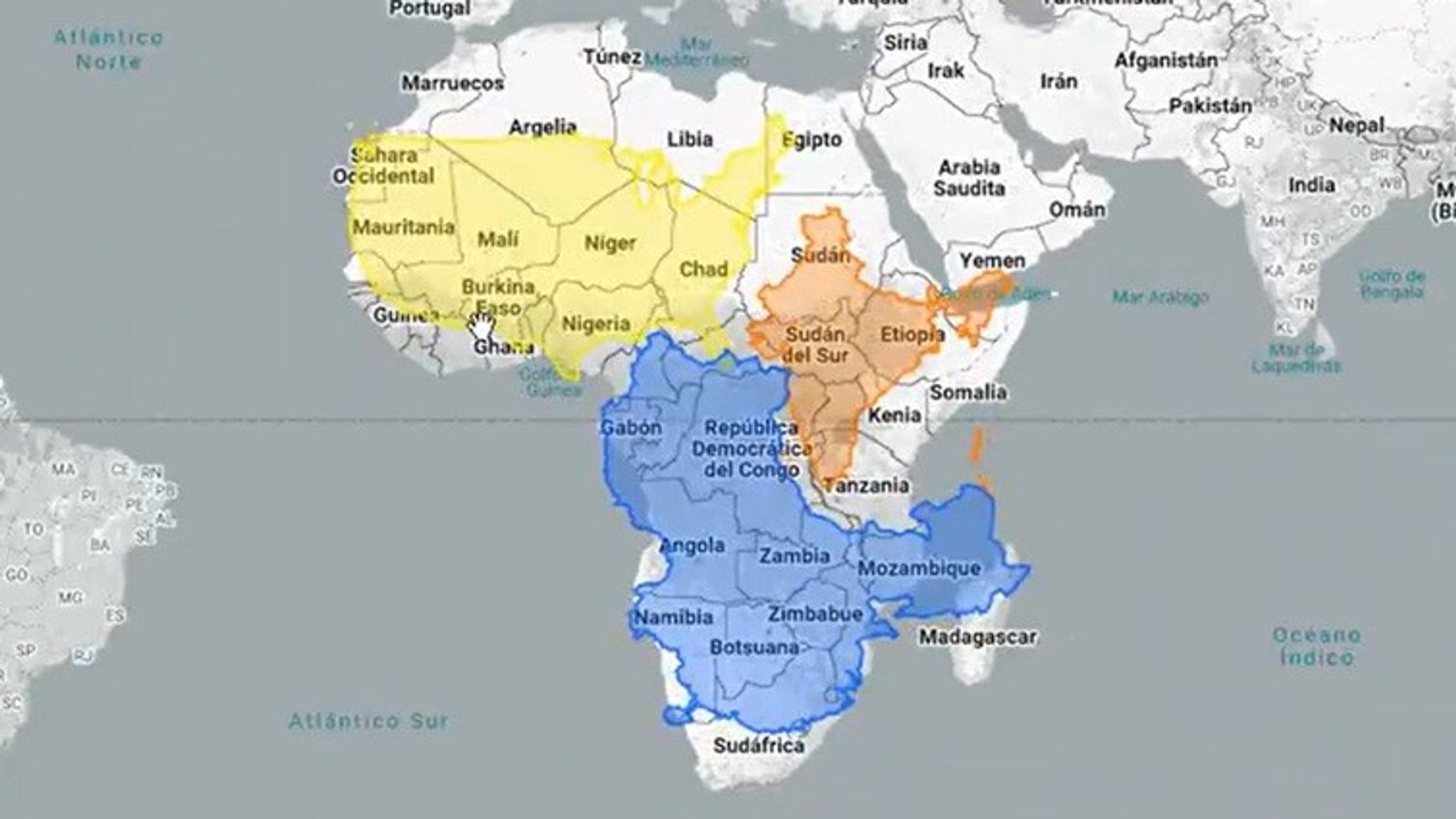
On 4 September 2026 Togo submitted a resolution to the United Nations General Assembly calling for a gradual move away from the Mercator projection. The initiative is backed by the other 54 members of the African Union and asks states, schools, international organizations and technology companies to adopt maps that show land areas more accurately.
The concern is easiest to see with Africa and Greenland: on the Mercator projection the two can appear roughly comparable, while in reality Africa covers more than 30 million square kilometres and is about 14 times larger than Greenland.
The distortion is not a mistake by Gerard Mercator. The Flemish cartographer developed his projection in 1569 to aid navigation: it preserves compass bearings, which made long-distance sea travel easier. The trade-off is severe distortion of land areas — the farther from the equator, the larger landmasses appear on the map.
Alternatives and trade-offs
Cartographers stress that no flat map can perfectly represent the globe. Different projections preserve different properties: some keep shapes, others preserve area, distance or direction. The Gall–Peters projection preserves relative area, which restores more appropriate sizes for Africa and South America though their shapes look stretched. The Winkel–Tripel aims for a compromise among area, distance and shape and has been used by National Geographic for world maps. The Robinson projection accepts smaller deformations across many places to create a visually balanced view. The Equal Earth projection was created in 2018 and its main advantage is that it preserves relative areas of countries and continents.
The Togolese initiative frames the issue as scientific rather than political. The country's foreign minister, Robert Dussey, said that Africa is not seeking privilege and that it wants its geographic size to be shown as it really is.
The proposed resolution would not be legally binding, but if adopted it could encourage changes in school curricula, institutional practices and digital platforms that produce or display world maps.
Photo: press material from the event