NASA displayed Crimea as part of Russia during eclipse broadcast
Viewers objected after a map in the live feed showed a border between Crimea and mainland Ukraine but no dividing line between the peninsula and Russia.
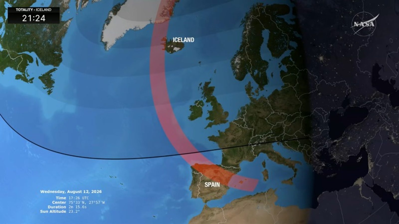
NASA drew criticism during its live coverage of the solar eclipse on August 13, 2026, after a broadcast graphic showed Crimea as part of Russia. The live feed included a map of Europe used to illustrate viewing paths and locations where the eclipse could be observed.
The network streamed the event while the total eclipse was visible from Greenland, Iceland, northern and central Spain and parts of Portugal. A map graphic in the broadcast displayed a border between the Crimean peninsula and mainland Ukraine, but did not show a border between Crimea and Russia.
Social media reaction and calls for correction
Viewers reacted on social networks, with some asking whether NASA “has a problem with international law.” One social-media post joked: "Bring another NASA, this one is broken. During the live stream of the solar eclipse NASA showed Ukrainian Crimea as Russian. And they say eclipses don't affect people…"
Following the complaints, many users urged the agency to update the map to reflect internationally recognised borders and to show Crimea as part of Ukraine. The omission sparked debate online about the responsibility of international broadcasters to display borders in line with diplomatic recognition.
Russia occupied Crimea in 2014, but Ukraine and the majority of countries worldwide do not recognise the peninsula's annexation. Ukraine this year liberated 745 square kilometres of occupied territory, claims Zelensky.
Photo: Printskrin / Jutub/NASA