Interactive map shows where most Macedonians live in the United States
Interactive county-level map uses U.S. Census Bureau surveys from 2019–2024 to show where people of Macedonian ancestry live in the United States.
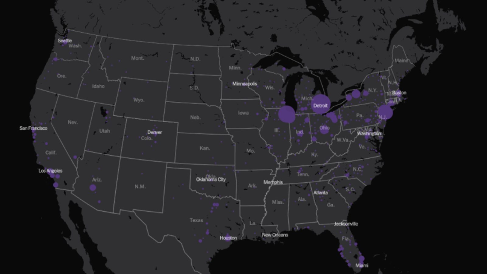
An interactive map published by an American newspaper has highlighted where people of Macedonian ancestry live across the United States, using recent census survey data to trace settlement patterns and concentrations.
The dataset behind the visualization draws on U.S. Census Bureau surveys covering the years 2019–2024. The project presents county-level estimates and an interactive display that lets readers explore how different ancestry groups are distributed across the country.
Context and purpose
The feature — released on the occasion of the 250th anniversary of the U.S. Declaration of Independence — is described by its creators as an effort to map the "complex tapestry of American roots." It combines maps, tables and local breakdowns to show both large metropolitan concentrations and smaller, unexpected pockets of ancestry.
For readers interested in Macedonian diaspora patterns, the presentation includes a section titled "Top 5 counties with the largest number of residents of Macedonian ancestry in the United States:" but the interactive map itself is the main tool for exploring those numbers at county and state level.
Analysts and community members can use the map to identify where Macedonian-origin populations are most numerous, how they are distributed between metropolitan and rural counties, and whether recent years show growth or decline in particular places. The underlying census surveys remain the primary source for all numeric estimates.
The visualization joins a broader trend of data journalism projects that apply recent census and survey data to tell new stories about migration, ancestry and regional settlement across the United States for 2019–2024.
Photo: press material from the event